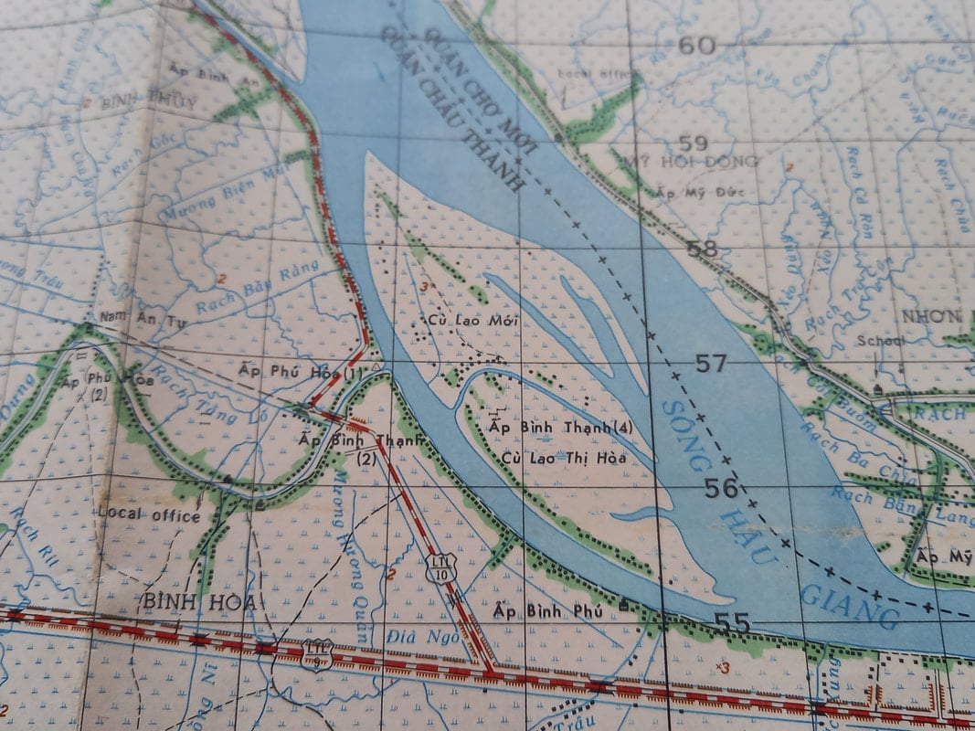
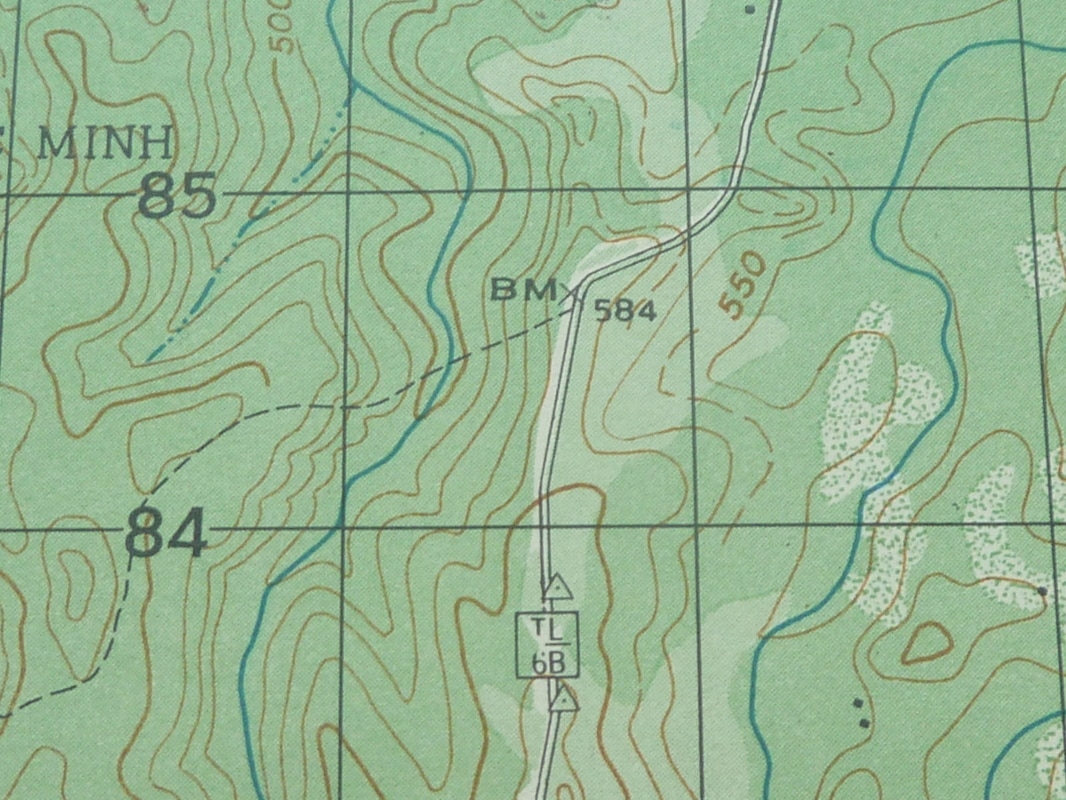
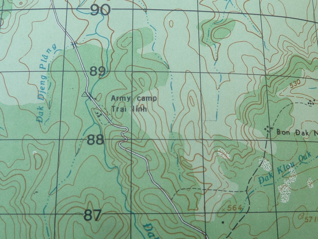
Khan Hoa 1971 Vietnam war map used by Viet-Cong/NVA fighters
Vietnam war map dated 1971 showing the area of Khanh Hoa.
A very interesting map showing US/ARVN Nha Trang air base, also known as McDermott and Long Van airfield, garrison of the US 14th special operations wing.
Used extensively by US helicopter air ambulances, the area saw much fighting throughout the war. Also shown Cam Ranh Bay site of large US airbase and port being a major US supply route until 1972.
Map also shows North / South railway and highway 1, other airfields South China sea plus rivers, roads etd.
Ref MP1
£14
US Army 1975 Vietnam war map Dinh Quan military area, Dong Nai strategic hamlets programme
US Army Vietnam war map dated 1975 showing the area of Dinh Quan sheet number 6431 11.
A very interesting map showing the Dinh Quan military area at the side of Highway 20, many walled villages which were part of the strategic hamlet programme to protect villagers from the Viet Cong. Also to stop them from joining the Viet Cong.
Also shows rivers, roads, jungle density and elevation etc etc
Ref MP2
£14
US Army 1967 Vn war map Long Xuyen airfield/watchtowers/militia post
US Army Vietnam war map dated 1968 showing the area of Long Xuyen sheet number 6029 1.
A very interesting map showing Long Xuyen, an all-weather airfield, many canal side watch houses, Ap Phung militia post and Hau Gian river.
Shows an area of mainly rice paddies, marshland etc all marked.
Ref MP3
£16.00
US Army 1971 Vn war map Atiun, Quang Nam US special forces
US Army Vietnam war map dated 1971 showing the area of Atium sheet number 6540 1V.
A very interesting map in the Quang Nam highlands with much fighting throughout the war. Due to the lack of roads it gave good cover for VC and NVA forces, so became an area of action by the US airborne and special forces.
Shows rivers, streams jungle densities and elevations plus settlements and province boundaries etc etc.
Ref MP4
£12.00
US Army 1970 Vietnam War Map Bon Dak N'Drot Army camp military installation
Very interesting map shows Cambodia's border, 2 military installations, an Army camp, B.M. markers, rivers, roads, jungle density and elevations etc etc
MP5
£12
US Army 1966 Vietnam War Map Hong Ngu Mekong Delta/Cambodia watchtowers etc
Very interesting map showing abandoned and strategic hamlets in Binh Than, many walled compounds to protect the South Vietnamese from the Viet Cong fighters,
Also shows riverside watch towers and militia post, Vietnam Cambodia border, an area of mainly rice paddies, swamps, rivers, roads, province boundaries etc etc
MP6
£18
US Army 1970 Vietnam War era map, army camp / military installations
Vietnam War era US army showing the area of Bon Dak N'Drot sheet number 6534 111.
A very interesting map with 2 military installations on Highway 68 close to the Cambodian border.
Also shows an army camp. B.M, markers, international border, province boundaries, rivers, roads, jungle density & elevations
Ref MP7
£14
US Army 1966 Vn war map Phi Sroin - Phey Srunh/Duc Xuyen airfields
Very interesting map with lots of information including Phey Srunh seasonal airfield/Duc Xuyen all-weather airfield. Also destroyed villages and hamlets, walled villages to protect villagers from Viet Cong forces and to stop them from joining the Viet Cong province boundaries, jungle density and elevations, rivers, roads etc
Ref MP 8
£12
Vietnam war 1971 Vn war map of Kien Giang site of US battle
A map used by NVA/VC fighters, showing the area of Kien Giang where a major battle took place during the war. Area near the Cambodia border making good cover for Viet Cong fighters. Shows many airfields, rivers, roads etc
.
In good original condition - see photos..
Ref MP9
£14
US Army Vietnam war 1969 Vn war map Chambak, Cambodia
US Army map showing the area of Chambak sheet number 6133 1.
A map used for US ARVN operations to track down Viet Cong fighters sheltering in Cambodia. Shows rivers, roads, province boundaries, settlements, jungle density and elevations etc
In good original condition - see photos.
Ref MP10
£12
Vietnam war 1971 Vn war map showing the area of Go Cong used by NVA/VC forces
North Vietnam Army map showing the area of Go Cong dated 1971.
A very interesting map showing airfields, rivers, roads, sea and surrounding provinces in the area of Go Cong.
Go Cong was the site of a 1963 battle where the ARVN 4th Corps and US army managed to kill 66 Viet Cong fighters and capture 91 new Viet Cong recruits, the ARVN soldiers were trained by USMC advisors.
In good original condition, see photos.
Ref MP11
£16
Vietnam war 1971 map showing the area of Kontum used by NVA/VC fighters
A very interesting map used by NVA/VC fighters showing the area of Kontum and the boundaries of both Laos and Cambodia, with the North South Ho Chi Minh trail running down.
Also shows rivers, roads, jungle density and elevations etc etc.
In good original condition, see photos.
Ref MP12
£14